Daniel001
-
Posts
12 -
Joined
-
Last visited
1 Follower

Recent Profile Visitors
1,053 profile views

Daniel001's Achievements
")
Gongoozler (1/12)
0
Reputation
-
Hi Loafer, what's the significance of the apostrophe mate?
-
Derek, I believe this site was demolished in 2008 following a fire caused by a cannibis factory.
-
Hi Matty, thanks for that. I'll see if I can get in touch.
-
Hi Ian Mac, thanks for your message. Would you happen to know which brewery it was? Thanks Hi Ian Mac, thanks for your message. Would you happen to know which brewery it was? Thanks
-
Hi AMModels, thanks for your message. I will definitely chase it up with local breweries.
-
Hi AMModels, thanks for your message. I will definitely chase it up with local breweries.
-
Hi, does anyone know of or have any reference to a map that shows clearly Telfords new main line detailing where it exactly started and finished? Many thanks
-
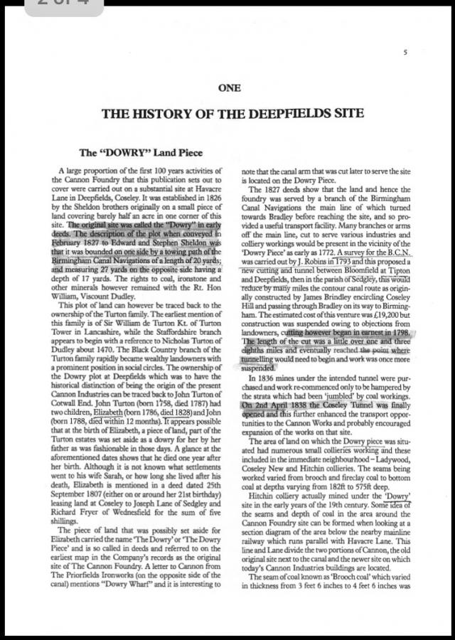
Hi Ritchard, sorry for the vague message. I don't know what book it's from however in the email from CRT that I have uploaded earlier it states it is an extract from "a History of the Deepfields Site".
-
Hi, these are the images related to my earlier post from CRT Hi Ritchard, Dudley council are stating a retaining wall separating the former site of the Bulls Head and the canal tow path is in need of repair. I have asked several different people regarding ownership of the wall and they all seem to state that CRT and before them British Waterways owned this wall however CRT (presumably due to the cost of repairing this wall) are not having any of it and are instead adamant I fix/repair it. Hi Nicknorman, I'm confused aswell. This is the third different version of the site and quiet frankly none of it seems to make any sense!

-
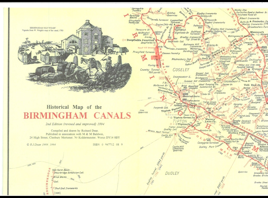
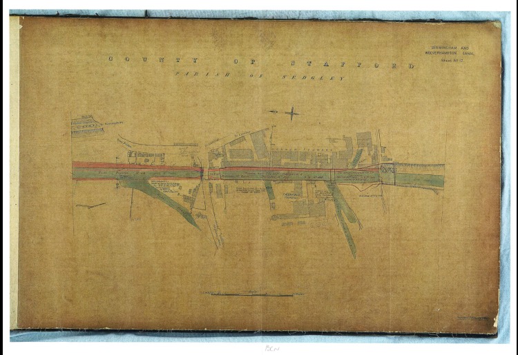
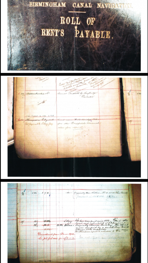
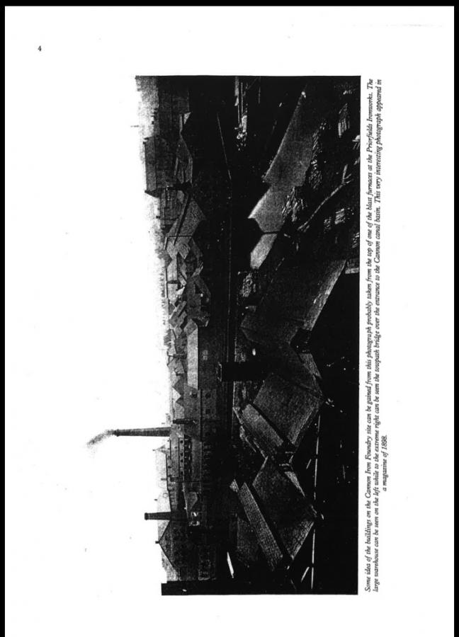
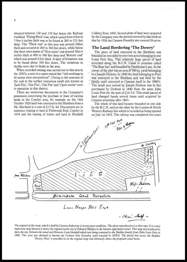
Hi Nicknorman, thanks for your message. This is what CRT are telling me. (In actual fact it's the third different statement they have made in response to this issue). I have got some images with their email but I'm unsure if I'm able to upload them to here! This is what CRT are stating: "The research has shown that the part of the canal adjoining the Boat Inn in Deepfields, Coseley was in fact, completed in 1794, and not the 1830s- please see the first attachment, which is an extract from a Historical Map of the Birmingham Canals. As you will see, the relevant section has been highlighted on the extract, and it was only the Coseley Tunnel which was built in the 1830s. The next attachment is a copy of an 1896 survey plan of this section of the canal. You will see that, to the south of Hill Bridge, there is written R.P. No.50. This is a reference to entry number 50 in the Roll of Rents Payable for the Birmingham Canal Navigation, and I attach an extract from that Roll. This shows that the Canal Company paid a rent for land near Hill Bridge for spoil (i.e. the matter which was dug out when the canal was formed in the late 18th century)- from the survey plan, this seems to include land which now forms part of your property. On the land beside the canal, including what is now the former site of the Boat Inn, a foundry was established 1826. This is stated in the extract from a History of the Deepfields Site, which I also attach. You will note that the original Boat Inn building was immediately adjacent to canal, as is shown on the sketch plan in the extract, rather than the later building which was set back towards Havacre Lane. Going back to the extract from the Roll of Rents Payable, the final page, which is in fact a continuation of the same page of the ledger, shows that the rent which the Canal Company was paying was reduced in 1813, and it is stated that the spoil is now occupied by a small Iron Work. The rent would have been reduced when the land was built on, in the construction of the foundry. It would appear that a wall would then have been constructed between the land occupied by the foundry and the canal towpath, to keep the spoil from falling back onto the towpath. From the above, it would appear that a wall separating the canal from the Boat Inn would not have been needed as part of the construction of the canal at this point in the late 18th century, and that such a wall was only built later when the land adjoining the canal was built on, which was in the 1820s.
-
Harry Peterson: thanks for your message. I'm familiar with what you have mentioned however C&RT have stated this section of the canal was built back in the 1700s and so pre dates the Boat Inn. Tim Lewis: What is your point? X ALAN W: Hi mate, thanks for your message.
-
Hi, Im trying to determine whether the Boat Inn Public House on the corner of Havacre Lane & Biddings Lane come first or the Canal that runs adjacent to it. The canal & river trust are adamant the canal was there first but can offer no genuine argument to support this statement. Instead they are trying to bamboozle me with a concuction of different stories that differ vastly. If anyone has any information on this issue or on how this section of canal was constructed (given the difference in ground levels) can you please contact me ASAP. It would be most appreciated. Thank you.